

Home » Free Printables » Printable Maps » North Dakota
Printable North Dakota Map Collection
County Map - City Map - State Outline Map

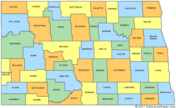
North Dakota County Map with County Names
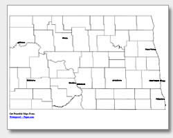
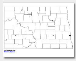
Map of North Dakota Cities with City Names
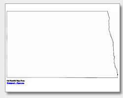
North Dakota State Outline Map

Blank North Dakota County Map
Blank North Dakota City Map
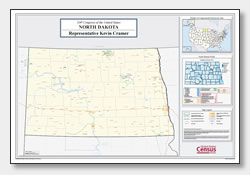
North Dakota Congressional District Map
(114th Congress)
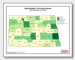
North Dakota County Population Map
(2010 Census)
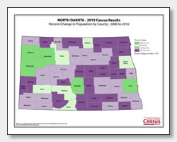
North Dakota County Population Change Map
(2000 to 2010 Census)
ADVERTISEMENT
Click the map or the button above to print a colorful copy of our North Dakota County Map. Use it as a teaching/learning tool, as a desk reference, or an item on your bulletin board.
Here we offer printable North Dakota maps for free! Choose from five maps, which include: two city maps (one with major city names listed and the other with location dots), two county maps (one with the county names listed and the other blank), and an outline map of the state of North Dakota. The city names listed are: Williston, Minot, Dickinson, Mandan, Jamestown, Grand Forks, West Fargo, Fargo, Wahpeton and the capital city of Bismarck. The .pdf files can be downloaded and printed on almost any printer. You will find that these great maps have a variety of uses, whether for planning, reference, educational or personal.